
Technology Report
October 20, 2026
SOTEN Digital Twin
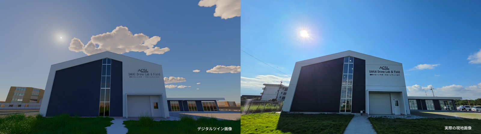
Teaching a drone to find a person in a disaster zone usually means a lot of test flights, and some of the conditions that matter most, such as bad light, wind or a damaged site, are dangerous, expensive or hard to repeat. On October 20, 2026, the Tokyo startup SpaceData and the drone maker ACSL announced (in Japanese) that they had taken search functions developed entirely in a virtual environment and run them on a real aircraft, ACSL’s Japanese-built SOTEN industrial drone.
The virtual environment is what engineers call a digital twin: a detailed 3D computer model of a real place that behaves closely enough like the original to test against. SpaceData says its team rebuilt the Sakai Town Drone Lab and Drone Field in Ibaraki Prefecture, including its research building, indoor test hall, outdoor flying field, netted flight cage and parking lot. The company stresses that this is not just a 3D picture but a model built for operations, where flight paths, camera field of view, object recognition and the effect of environmental conditions can be checked. The test scene includes the airfield, takeoff and landing spots, buildings, human figures and colored markers.
SpaceData’s robotics team built a model of the SOTEN in NVIDIA Isaac Sim, a robot simulation program, and connected it to the same ground-control software used to fly the real drone. According to the release, commands such as takeoff, fly to a point, turn and land can be sent to the virtual aircraft, and the simulated camera feed is passed through image recognition with results returned to the operator’s screen. The companies say they are developing two search behaviors this way: one finds a colored marker, approaches its estimated position and hovers above it; the other searches for a person and hovers at a monitoring position while keeping a safe distance. Because weather, time of day, lighting, background and target position can all be changed in the simulator, SpaceData says teams can rehearse conditions that are hard to repeat in the field and narrow down what still needs a real flight test.
The new step is the hand-off to hardware. The companies say they confirmed sending commands to the real SOTEN, receiving its camera video and controlling its gimbal, the motorized mount that points the camera. They then ran the marker-search function developed in simulation on the real drone and, according to the release, completed a sequence of automatic takeoff, target detection using live camera video, and a decision to hover, followed by a manual landing. Person search has so far been described only as under development. The release is candid that the virtual and real aircraft do not yet match perfectly, listing video lag, camera angle of view, gimbal-angle conventions and radio conditions as gaps the team is working on.
Next, the companies plan to run the same marker and person searches repeatedly in both the simulator and the real field, recording sunlight, wind and GPS quality, and comparing flight tracks, detections, final positions, video and control logs. SpaceData and ACSL frame the work for defense, disaster prevention and infrastructure, and say disaster uses include locating people in affected areas. The release gives no detection accuracy, timeline or customers, and claims about safety and efficiency gains are the companies’ own.